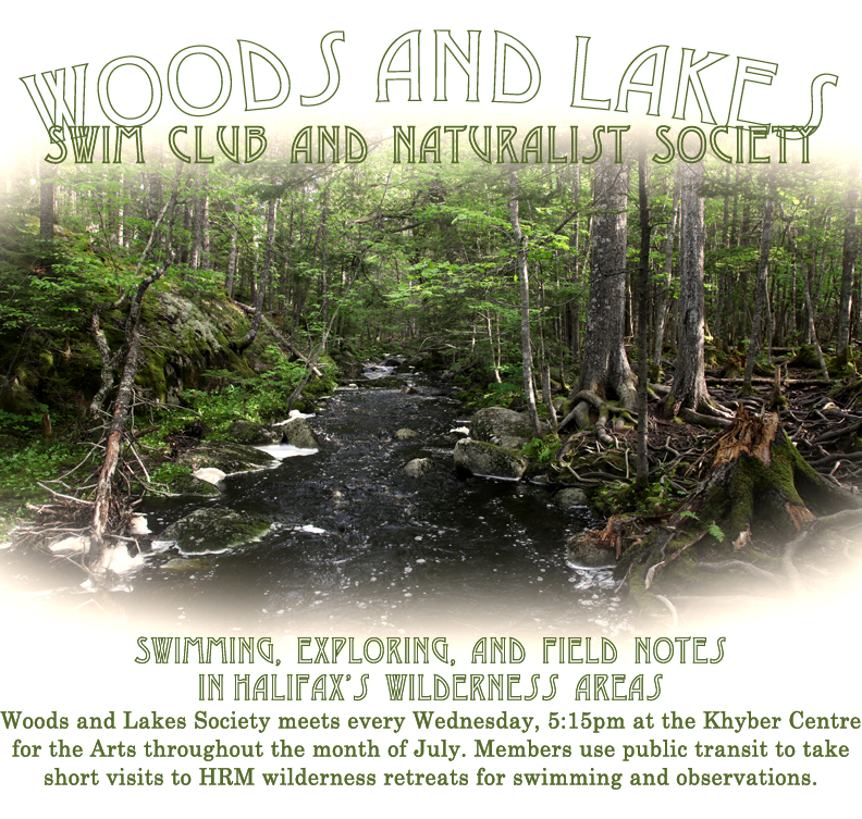
Document 2: Woods and Lakes
by protectyourlove
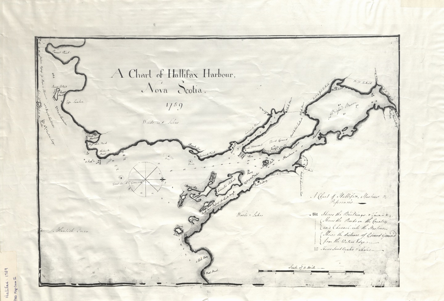
Courtesy of Nova Scotia Archives, Halifax, NS
I have come across this map from the year 1759. Created only 10 years after the drawing in my previous post, according to this image nearly half of the peninsula had already been cleared. This early nautical chart also gives some indication of the terrain around the peninsula, and thus quite possibly the land that was being leveled: woods and lakes.
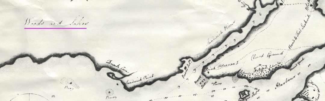
And so the large expanse of land around the young city was comprised of untouched forest and fresh water.
What would that have been like? Which animals would have made homes near those lakes?
In an effort to learn more, I have begun a society called “The Woods and Lakes Swim Club and Naturalist Society”. Together, we will visit the lakes mentioned in the above map, in their present state. We will swim, we will consider our surroundings, and we will take notes.